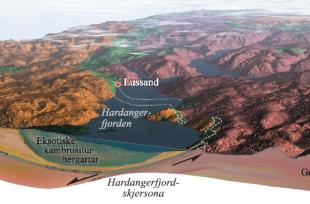
The Caledonian mountain building event was extremely stressful for the earth's crust in western Norway. Strong forces pressed Greenland toward Norway such that the crust compressed to double its thickness many places. About 400 million years ago, these forces decreased or dissipated. The aftermath of the collision took quite a toll on the unusually thick Earth's crust along the mountain chain. The crust collapsed and got eroded away, so that the two continents slipped slightly away from each other. Along what is now Hardangerfjord, the earth's crust probably collapsed from top to bottom along the Hardangerfjord shear zone – a plane that slopes toward the northwest. On the northwest side of this zone the ground sank down several kilometres. A shear zone is a zone of movement deep down in the earth's crust, where the bedrock gets stretched almost like a dough.
The geological map picture of Hordaland reflects this movement. On the Folgefonna peninsula the Precambrian basement was carried all the way to the top, and is even found on tops that are over 1500 metres high. Also on Hardangervidda plateau, the basement is high up, with remnants of the flay-lying thrust sheet on the highest tops. On the northwest side of Hardanger Fjord, however, the basement most places has been buried deep under the thrust sheet that had been lying on top of the basement during the mountain building event. If one follows the surface of the Precambrian basement, it lies deep down on the northwest side of the fjord. Thus, the basement surface is like a gigantic staircase.
Water and ice have better working conditions along the old shear zone than otherwise in the bedrock. Hardangerfjord has therefore been chiselled out along this zone. Much of the carving has been done by glaciers, but even before the ice ages there was a river that started the work. It was notably easier to erode the thrust sheet made of weak Cambro-Silurian rock types on the northwest side than to erode the hard Precambrian basement rocks on the Foglefonna peninsula. The height difference today thus bears witness to this geological staircase.
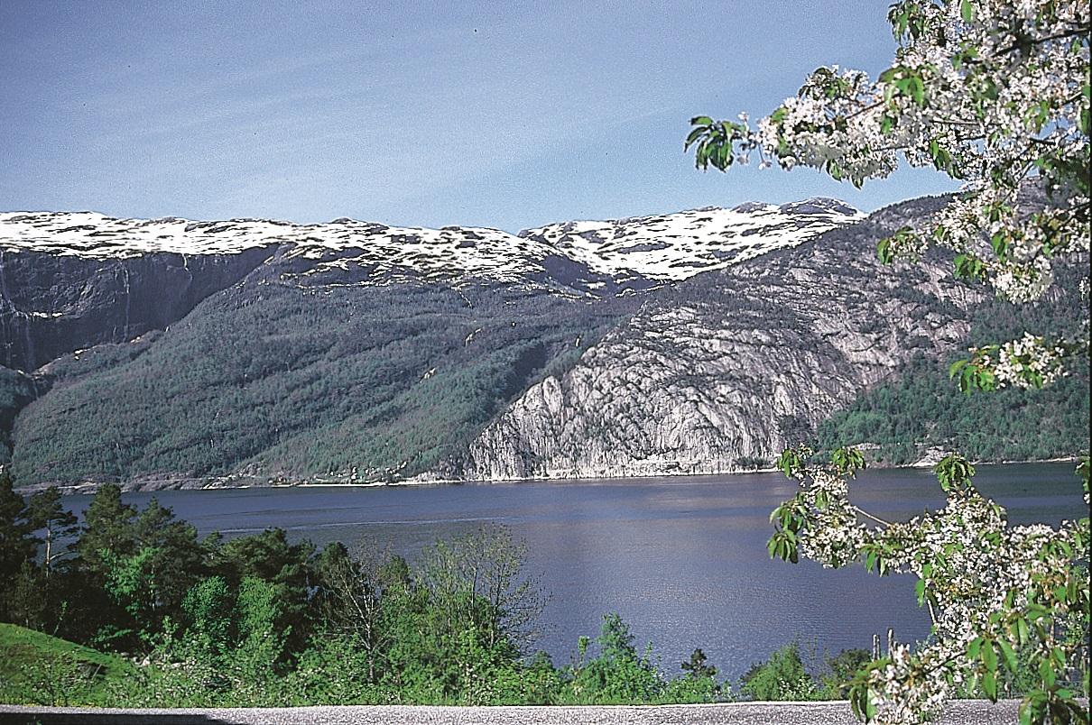
Innermost in Hardanger Fjord much of the Cambro-Silurian layers disappear, and with this also the difference in height. The contrast between the naked rock and the forested slopes at Lussand shows clearly where the Cambro-Silurian layers end and the Precambrian basement takes over. At this spot the Hardangerfjord sheer zone comes up from the fjord.

