Bygdeborga på Borgåsen (Helge Sunde).

The defensive refuge at Borgåsen

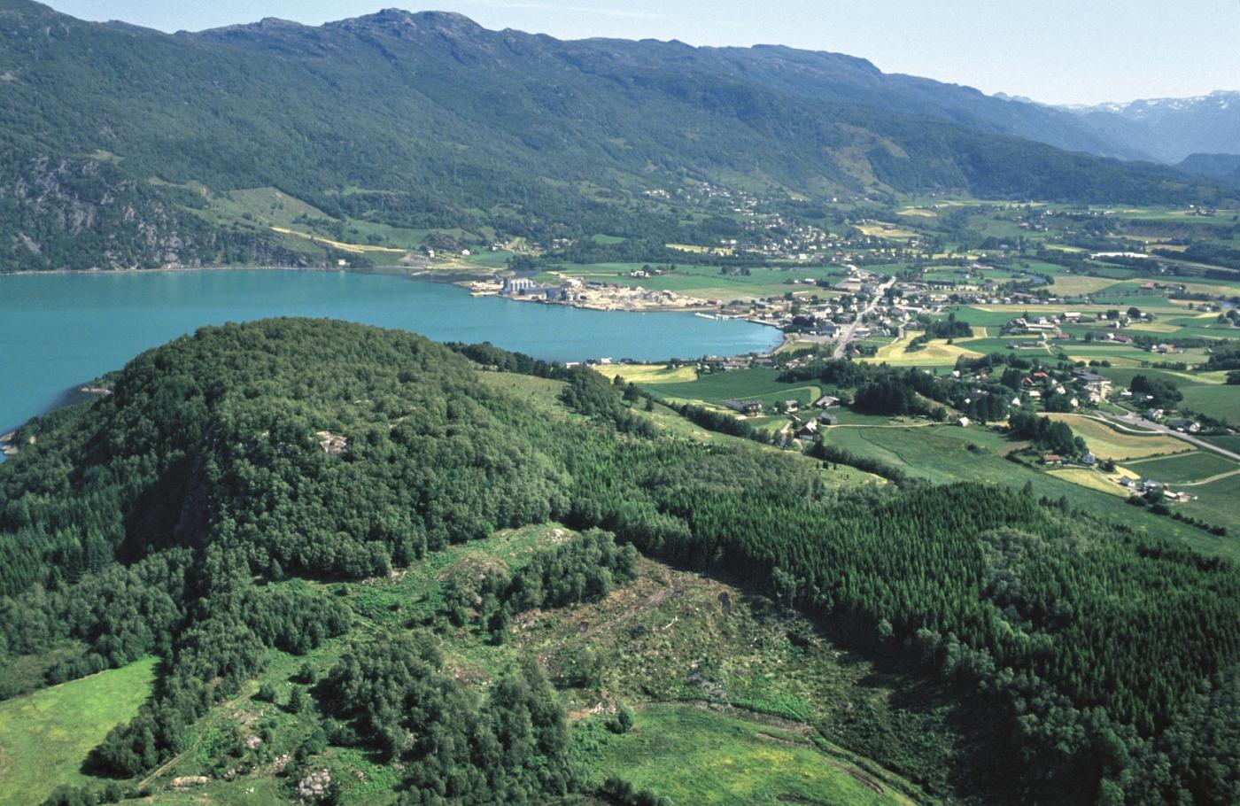
The defensive refuge at Borgåsen with Etne Fjord and Etne Lake in the background. (Helge Sunde).

Borgåsen

In Etne there are no less than four defensive refuges. They are all situated in strategic positions, so that they have served as places of refuge and protection for central parts of the district

Borgåsen, on the south side of Etnepollen (an arm of the fjord), takes its name from the fortified refuge from the Dark Ages, of which there are still traces. On the top there is a flat area, with steep slopes on three sides. On the fourth side a great wall has been put up, and remains of this are to be found within the area of fortification. One gets a full view over the sailing entrance to the Etne district from Borgåsen.

On the north side of Etnepollen, on the Bryllum farm lies Holenuten. You can only get up on to the top from the northeast. And up there are walls and barriers. In a little cave here charcoal and iron slag has been found.

Heia in Steine is an elevated height with an extended surface on the top and steep slopes on three sides. A great stone rampart, 36 metres long and 6 metres wide runs right across the surface and cuts off the 40 metres by 20 metre wide fortified area.

Hushaug is the name of a hill with steep slopes just above the Vad farm. On the only accessible side lies an 80 metre long wall which cuts off an area of 80 metres by 50 metres. From the fort at Vad there is a broad view out over the main district and up Stordalen valley. And here three old road routes come together: the road from Støle, the road from Grindheim and the road up through Stordalen valley. Vad gets its name from an old ford across the Stordal River.
I romartid og folkevandringstid (Kr.f.-600) vart det bygt forsvarsborger på toppar og fjellknausar som frå naturen si side var vanskelege å koma til. Der tilkomsten til borga var lettast, vart det lagt opp store steinmurar eller vollar av jord og sand. Truleg har det i tillegg vore palisadar av tre.


Bygdeborger av dette slaget er lite granska av arkeologane. Vi veit difor ikkje stort om korleis desse forsvarsanlegga såg ut den tid dei var i bruk, og det er heller ikkje mykje vi kan seia for visst om korleis forsvaret av dei vart organisert, og kva funksjon dei hadde for bygda eller for regionen. Somme har truleg vore tilfluktstader for folk som budde i den næraste omkrinsen, men det er ting som tyder på at andre kan ha vore del av eit organisert forsvar av større hovdingdøme eller smårike.


I Hordaland kjenner vi 19 bygdeborger. Av desse ligg heile 12 samla innanfor eit mindre område i Sunnhordland. I Nordhordland er det 3, i Hardanger 4.


Borgene i Sunnhordland ligg slik til at det er frie siktliner mellom dei. Mange ligg sentralt i bygder som har vore tett busette i romartid og folkevandringstid. Frå dei same bygdene kjenner vi rike gravfunn med importerte romerske statusvarer. Truleg har det butt hovdingar her som kunne organisera forsvar av eit smårike i Sunnhordland. Frå borga på Steinslandsåta i Ølen er det såleis vidt utsyn over heile det sentrale Sunnhordland. Herifrå kan ein sjå til borger i Etne, Kvinnherad og Sveio.


I somme bygdeborger er det funne spor etter hustufter og brunnar eller vassgroper, der regnvatn kunne samlast opp. I slike borger kan folk ha halde til i vekevis under ufredstider.

See also

Places in muncipality